
たつむりそろそろ登れ富士の山
Slowly, snail, slowly climb Mount Fuji. –Kobayashi Issa
Our fearless adventurers donned their packs and headed up the trail. The altitude announced itself quickly as heart and breathing rates worked to keep up. The path started as a smooth, soft carpet of pine needles, a gentle rise through the forest, but then, as Gerry Roach might say, “the introduction was over” as they arrived at an imposing rocky ridge.
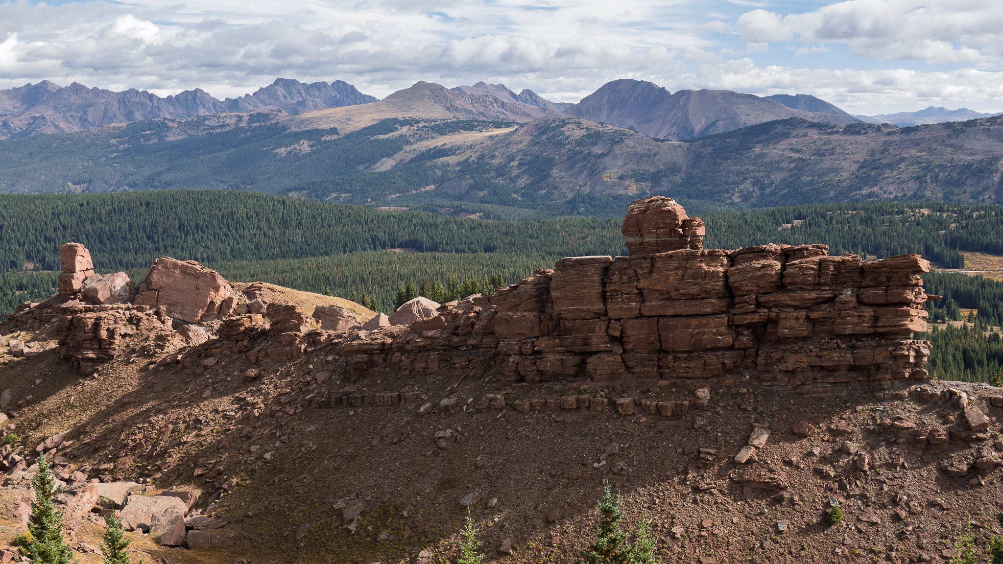
We go that way, said D.
For intrepid explorers, that’s always the way. It’s as though, given a choice, we choose the difficult, the labored breath, the rocky ridge, the clouds and the storm.
The day began in the middle of the night, with a dream about being extremely thirsty and accidentally gulping a bottle of bleach, searching for an ER, and discovering that none of the medical professionals seemed particularly alarmed: “It’s harmless in small amounts,” quipped they.
Thankfully, an alarm clock happened, the dream fizzled, and one bleary adventurer was left to ponder whether it was safe to mix “small amounts” of toothpaste and bleach.
D showed up to save the day, and with backpacks and sunblock loaded in the back of the car, the intrepid explorers hit the road, en route to Vail Pass.
Not much traffic. Sun rising peach and orange. Phones warning about “construction ahead,” and “a car on the shoulder in 3.2 miles.”
Along the way, they stopped for coffee at the amazingly well-stocked “Mountain Tool and Feed Country Store,”1 whose parking lot includes a bronze statue of a bear, some incredibly sturdy concrete cubes painted with idyllic scenes of mountain life, and a lot of trucks. Turns out they have some pretty good coffee. And you could get pretty much anything else you want there: sunblock, oxygen canisters, keychains, t-shirts, tire chains, flashlights, ice cream.
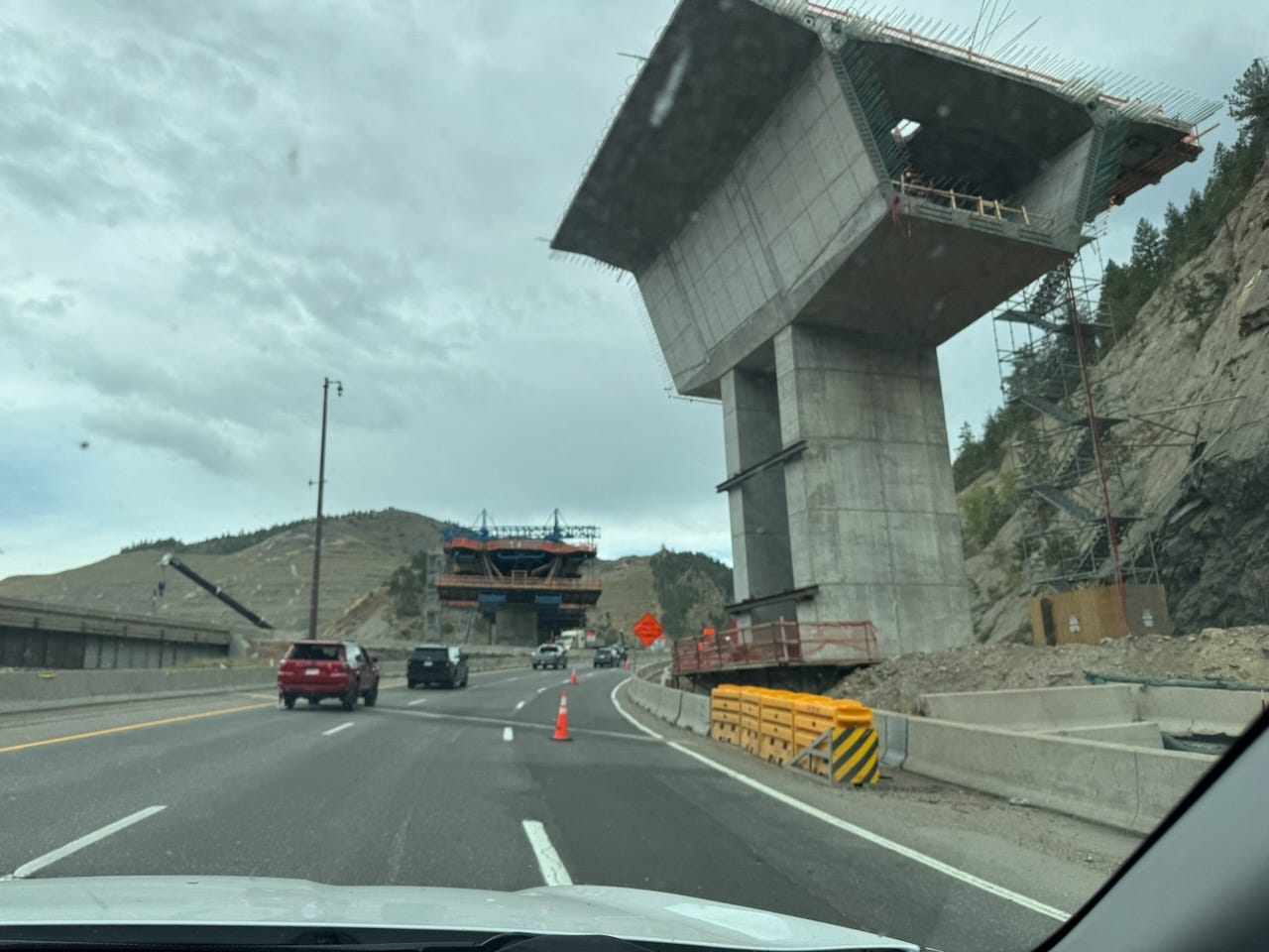
Back on the road to Floyd Hill, gargantuan post-apocalyptic concrete pillars loomed over the highway. This was the I70 Floyd Hill Project, a huge, multi-year road improvement project, designed to straighten the curves, ease the road grade, and improve safety.2
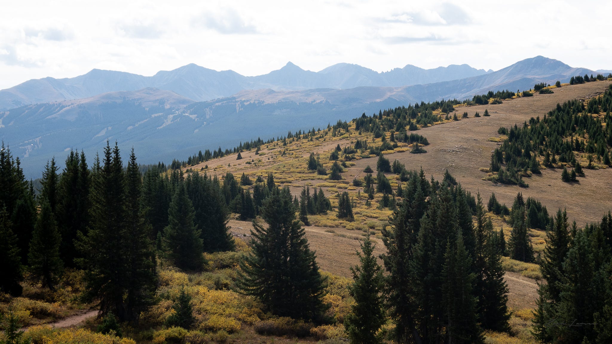
Through the Eisenhower Tunnel, up to Vail Pass, Exit 190, and two rock-strewn miles later, they arrived at the Shrine Ridge trailhead. Only one other car in the lot, its occupants already trudging up the trail. The phone said the temperature was 40-ish, but no way — the air felt more like 60, and nary a breath of wind. Peaks in every direction, pastoral clouds posing for renaissance paintings, as though dreaming they might someday become storms.
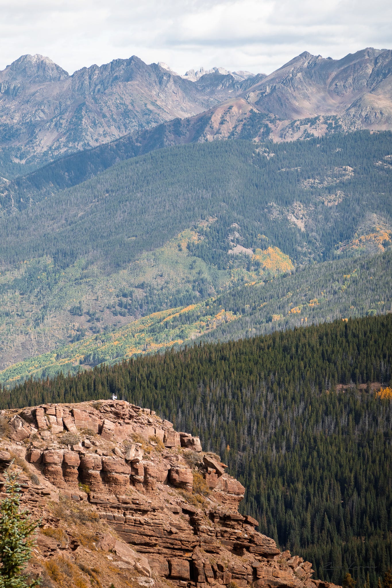
Back on the trail, our fearless adventurers huffed and puffed up the trail along the rocky outcropping. The views improved with every step: stop to catch your breath, and the view just takes it away again. Mountains everywhere: Copper Mountain, Pacific Peak, Quandary, Harvard, Elbert, Holy Cross. Eventually our fearless adventurers reached the “summit,” which was just a metal survey marker embedded in a rock. To the north, a rock pinnacle (likely the “shrine”) rose up from the valley below.
And a guy on a FaceTime call, because hey, we have three bars.
Ok fine, our fearless adventurers stepped around him, silent as the night — and you might not believe this — nary a grunt, not even a glare. Well, he finished eventually, signed off, and trudged down the trail.
S and D took the opportunity to grab a snack bar, gulp some water, take some summit photos. You know, the usual.
On the way down, something in the tundra. Fifty, sixty yards away, a head popped up from the grass, vanished again. And then slipped up onto on a rock, its mouth full of grass, and looked around.
D decided it was a stoat, and announced to everyone within earshot (basically, S), “It’s a stoat!”
Upon this proclamation, dear Reader, you might wonder, as did the group of hikers who stopped a moment later to peer with us at the mystery mammal: “What the heck is a stoat?” To which D set about describing the qualities and aspects of stoats: small, brown, high altitude, turns white in the winter, not a rabbit, not a marmot, not a pika. One hiker graciously observed, “is it sometimes called a ‘weasel?’” Why yes, exclaimed D, or in winter, an ermine!
This went on for a bit, discussing biology and etymology at 11,500’ in the middle of a tundra field, with a slight breeze and pleasant clouds.


S and D proclaimed “stoat” to be the word of the day, and throughout the entire descent and subsequent drive to Idaho Springs, our fearless adventurers brainstormed various stoat-ish phrases they could employ during lunch or group gatherings or future adventures or whatever:
stoat on a stick
bloated stoat
a stoat in hand is worth…
D even added “stoat” to his family’s vaunted “anagram list” (cf., toast).
Henceforth along the trail, if anyone asked whether our intrepid explorers had seen any critters, well, they had an answer. Moose? Not a whiff. Stoats? As far as the eye can see.3
P2 Tommyknocker, Idaho Springs
On the way back down I-70, our intrepid explorers made note of the various license plates; in no particular order: NY, TX, ID, IA, MO, FL, MN, PA. PA had a URL, so S & D realized they’d have to check it out. But not while driving. This called for a stop at Tommyknocker Brewpub in Idaho Springs, ostensibly for lunch, but also to take advantage of their wifi to investigate PA’s website.
S had a salad, D had a cheeseburger, de rigeur. The website was ok, but needs wifi (not cellular) because it has video on the main page. Why the url is on the license plate, who knows.
Otherwise uneventful, and back by about 2pm.
And a rather successful BMO.
☶
Mountain Tool and Feed, https://www.facebook.com/mountaintoolandfeed/
Colorado Dept of Transportation, I-70 Floyd Hill Project https://www.codot.gov/projects/i70floydhill
AI decided, after looking at the photos, that it was a marmot. Which is not really an anagram of anything.